

BALTIMORE — Good Tuesday night!
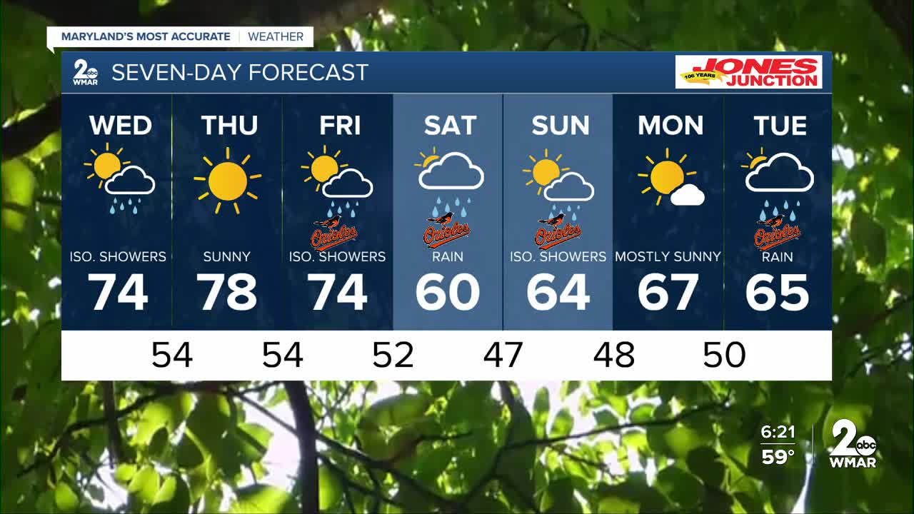
After a gorgeous day, rain showers return tomorrow. The best chance for rain will be in the morning as a fast-moving front pushes through. Clouds will gradually decrease after lunchtime.
Blue skies return Thursday, but it won’t last long—rain moves back in for Friday and Saturday. Friday’s showers will be hit-or-miss, while a steadier, soaking rain arrives Saturday with totals around a half inch or more. The latest data suggests we may salvage Sunday, with drier conditions expected to return.
Dylan

7 Day Forecast:
Wednesday A chance of showers, with thunderstorms. Mostly cloudy, with a high near 72.
Wednesday Night Partly cloudy, with a low around 52.
Thursday Sunny, with a high near 77.
Thursday Night Partly cloudy, with a low around 54.
Friday Mostly sunny, with a high near 77.
Friday Night A chance of showers. Mostly cloudy, with a low around 54.
Saturday A chance of showers. Partly sunny, with a high near 67.
Saturday Night Showers likely. Mostly cloudy, with a low around 49.
Sunday A chance of showers. Partly sunny, with a high near 63.
Sunday Night A chance of showers. Mostly cloudy, with a low around 48.
Monday A chance of showers. Mostly cloudy, with a high near 67.
Monday Night A chance of showers. Mostly cloudy, with a low around 50.
Tuesday Showers likely. Partly sunny, with a high near 69.

