


BALTIMORE — Good Tuesday night!
Satellite and radar imagery show an upper-level disturbance sliding through the Ohio River Valley this evening. Most high-resolution computer models keep the bulk of the precipitation trapped along the western slopes of the mountains tonight. Still, it’s plausible that a few showers sneak into our viewing area. With ground temperatures hovering around freezing, some wet snow could mix in with the rain.
This is a fast-moving system, and any precipitation should wrap up by 9 AM Wednesday, followed by increasing sunshine through the afternoon.
Our attention then turns to a secondary system on Thursday. Recent model trends have shifted farther south, steering most of the deeper moisture toward Virginia and the Carolinas. Strengthening high pressure to our north will help suppress how far north that moisture can travel. We’re still expecting scattered rain showers — and perhaps a few snow showers — but rainfall totals have been trimmed back slightly.
Behind Thursday’s system, the weather looks delightful heading into the Friday–Sunday timeframe.

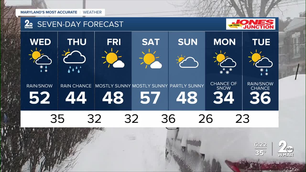
7 Day Forecast:
Wednesday A slight chance of rain. Partly sunny, with a high near 52.
Wednesday Night Partly cloudy, with a low around 34.
Thursday Rain likely. Mostly cloudy, with a high near 44.
Thursday Night A chance of rain. Mostly cloudy, with a low around 31.
Friday Mostly sunny, with a high near 45.
Friday Night Mostly clear, with a low around 31.
Saturday Sunny, with a high near 55.
Saturday Night Mostly clear, with a low around 36.
Sunday Mostly sunny, with a high near 48.
Sunday Night Mostly cloudy, with a low around 25.
Monday Partly sunny, with a high near 38.
Monday Night A chance of rain and snow. Mostly cloudy, with a low around 26.
Tuesday A chance of rain and snow. Mostly cloudy, with a high near 49.

