


BALTIMORE — Good Thursday night!
We’re heading into a cloudy, chilly Friday, and you’ll probably see a few flurries floating around during the day. Nothing major, but definitely a winter feel.
Temperatures do bump up just a bit on Friday and Saturday — we’ll be hovering around 40°F, so not exactly warm, but better than the deep freeze.
Our next weather maker arrives late Saturday night into early Sunday. It’s a fast-moving clipper system dropping in from Canada. These usually don’t have much moisture to work with, so they’re not known for big snow totals. Still, there will be plenty of cold air around, so anything that does fall should be snow. Light accumulations look possible early Sunday morning, so if you’re out and about early, keep an eye on the roads!
Stay warm out there!


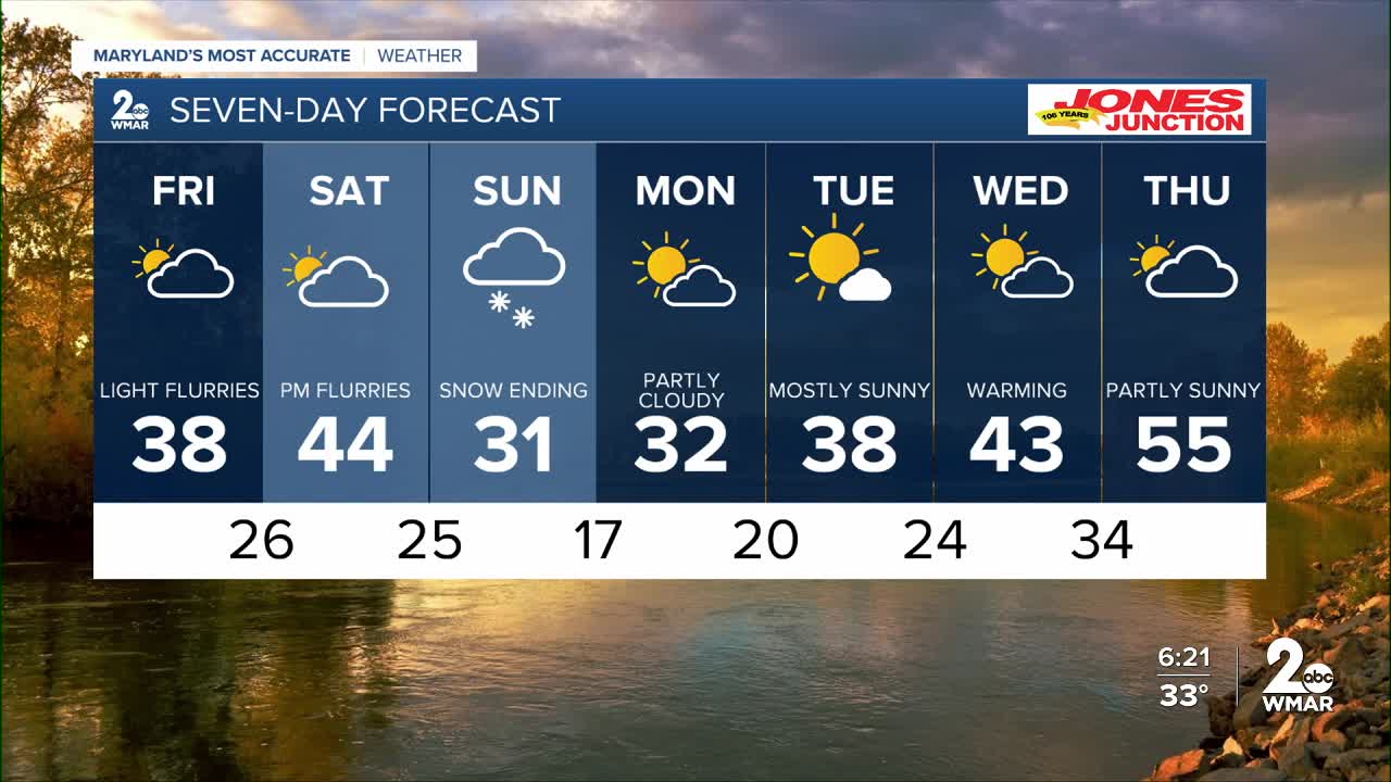
7 Day Forecast:
Friday A slight chance of snow. Partly sunny, with a high near 38.
Friday Night A chance of snow. Mostly cloudy, with a low around 26.
Saturday Mostly cloudy, with a high near 43.
Saturday Night A chance of rain and snow, then snow. Low around 25.
Sunday A chance of snow. Partly sunny, with a high near 32.
Sunday Night Mostly clear, with a low around 17.
Monday Mostly sunny, with a high near 32.
Monday Night Partly cloudy, with a low around 20.
Tuesday Mostly sunny, with a high near 38.
Tuesday Night Partly cloudy, with a low around 24.
Wednesday Partly sunny, with a high near 43.
Wednesday Night Mostly cloudy, with a low around 41.
Thursday A chance of rain. Partly sunny, with a high near 55.

